|
Area/Topic | Bibliography | Background | Hypotheses | Home |
Photo Pages: Meta Information
This page contains detailed information from the KRIS Photodatabase table about photos from sub-basin Dyer River and series Historical Topo Maps- Dyer River.
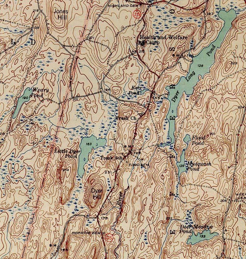
| Basin | Sheepscot |
| Caption | 1944 topographic map of the Dyer River. From the Wiscasset NE 1944 quad downloaded from http://docs.unh.edu/nhtopos/nhtopos.htm. |
| CaptionTemplate | [Description] |
| Category | Historical Topo Maps |
| Description | 1944 topographic map of the Dyer River. From the Wiscasset NE 1944 quad downloaded from http://docs.unh.edu/nhtopos/nhtopos.htm. |
| Filename | dyer_44.jpg |
| Filesize | 332217 |
| Meta_Id | UNH_topos |
| Notefile | sheepscot.htm#UNH_topos |
| Path | dr/dyer_44.jpg |
| Series | Historical Topo Maps- Dyer River |
| SubBasin | Dyer River |
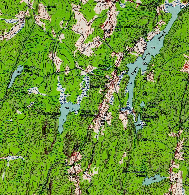
| Basin | Sheepscot |
| Caption | 1957 topographic map of the Dyer River. From the Wiscasset NE 1957 quad downloaded from http://docs.unh.edu/nhtopos/nhtopos.htm. |
| CaptionTemplate | [Description] |
| Category | Historical Topo Maps |
| Description | 1957 topographic map of the Dyer River. From the Wiscasset NE 1957 quad downloaded from http://docs.unh.edu/nhtopos/nhtopos.htm. |
| Filename | dyer_57.jpg |
| Filesize | 334942 |
| Meta_Id | UNH_topos |
| Notefile | sheepscot.htm#UNH_topos |
| Path | dr/dyer_57.jpg |
| Series | Historical Topo Maps- Dyer River |
| SubBasin | Dyer River |
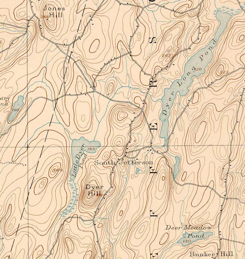
| Basin | Sheepscot |
| Caption | 1893 topographic map of the Dyer River. From the Wiscasset NE 1893 quad downloaded from http://docs.unh.edu/nhtopos/nhtopos.htm. |
| CaptionTemplate | [Description] |
| Category | Historical Topo Maps |
| Description | 1893 topographic map of the Dyer River. From the Wiscasset NE 1893 quad downloaded from http://docs.unh.edu/nhtopos/nhtopos.htm. |
| Filename | dyer_93.jpg |
| Filesize | 218613 |
| Meta_Id | UNH_topos |
| Notefile | sheepscot.htm#UNH_topos |
| Path | dr/dyer_93.jpg |
| Series | Historical Topo Maps- Dyer River |
| SubBasin | Dyer River |
| www.krisweb.com |