|
Area/Topic | Bibliography | Background | Hypotheses | Home |
Photo Pages: Meta Information
This page contains detailed information from the KRIS Photodatabase table about photos from sub-basin Mainstem Sheepscot and series Tour- Sheepscot R. Head Tide to Whitefield 2004.
| Agency | Institute for Fisheries Resources |
| Basin | Sheepscot |
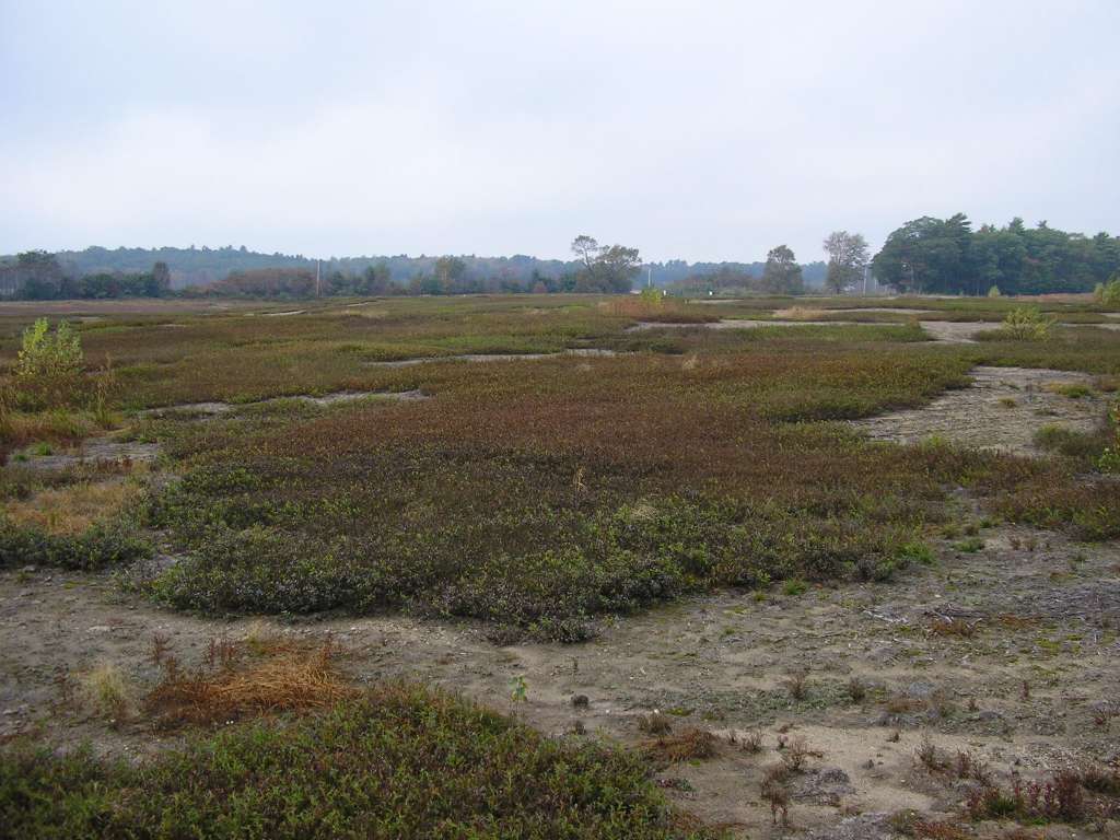
| Caption | This picture was taken from Highway 218 between Head Tide and Whitefield. It shows a blueberry field. This site is located in the Mainstem Sheepscot sub-basin. Photograph was taken by Eli Asarian on 10/9/2004. |
| CaptionTemplate | [description] This site is located in the [SubBasin] sub-basin. Photograph was taken by [photographer] on [photodate]. |
| Category | Watershed Tour |
| Description | This picture was taken from Highway 218 between Head Tide and Whitefield. It shows a blueberry field. |
| Filename | sheep_2004-10-09_06-41-46.jpg |
| Filesize | 99339 |
| Path | sheep_ifr_04\sheep_2004-10-09_06-41-46.jpg |
| Photodate | 10/9/2004 |
| Photographer | Eli Asarian |
| Restriction | None |
| Series | Tour- Sheepscot R. Head Tide to Whitefield 2004 |
| SubBasin | Mainstem Sheepscot |
| UpdateDate | 10/20/2004 |
| UpdateName | JEA |
| Agency | Institute for Fisheries Resources |
| Basin | Sheepscot |
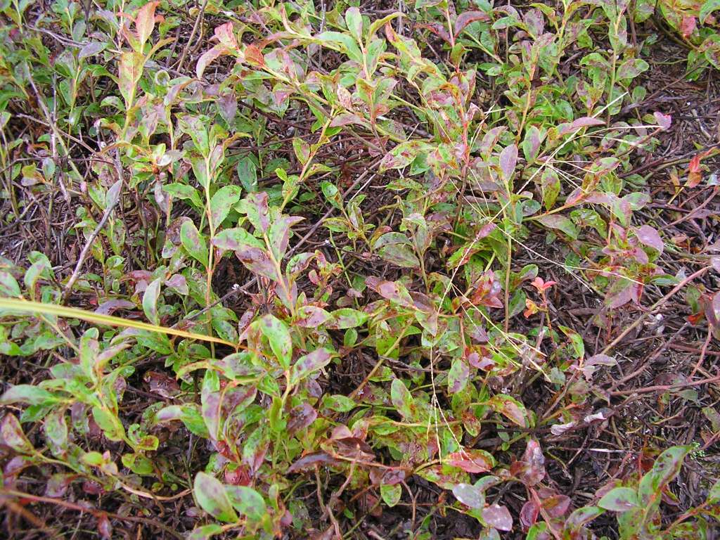
| Caption | This picture was taken from Highway 218 between Head Tide and Whitefield. It shows a closeup of a blueberry bush. This site is located in the Mainstem Sheepscot sub-basin. Photograph was taken by Eli Asarian on 10/9/2004. |
| CaptionTemplate | [description] This site is located in the [SubBasin] sub-basin. Photograph was taken by [photographer] on [photodate]. |
| Category | Watershed Tour |
| Description | This picture was taken from Highway 218 between Head Tide and Whitefield. It shows a closeup of a blueberry bush. |
| Filename | sheep_2004-10-09_06-42-10.jpg |
| Filesize | 199391 |
| Path | sheep_ifr_04\sheep_2004-10-09_06-42-10.jpg |
| Photodate | 10/9/2004 |
| Photographer | Eli Asarian |
| Restriction | None |
| Series | Tour- Sheepscot R. Head Tide to Whitefield 2004 |
| SubBasin | Mainstem Sheepscot |
| UpdateDate | 10/20/2004 |
| UpdateName | JEA |
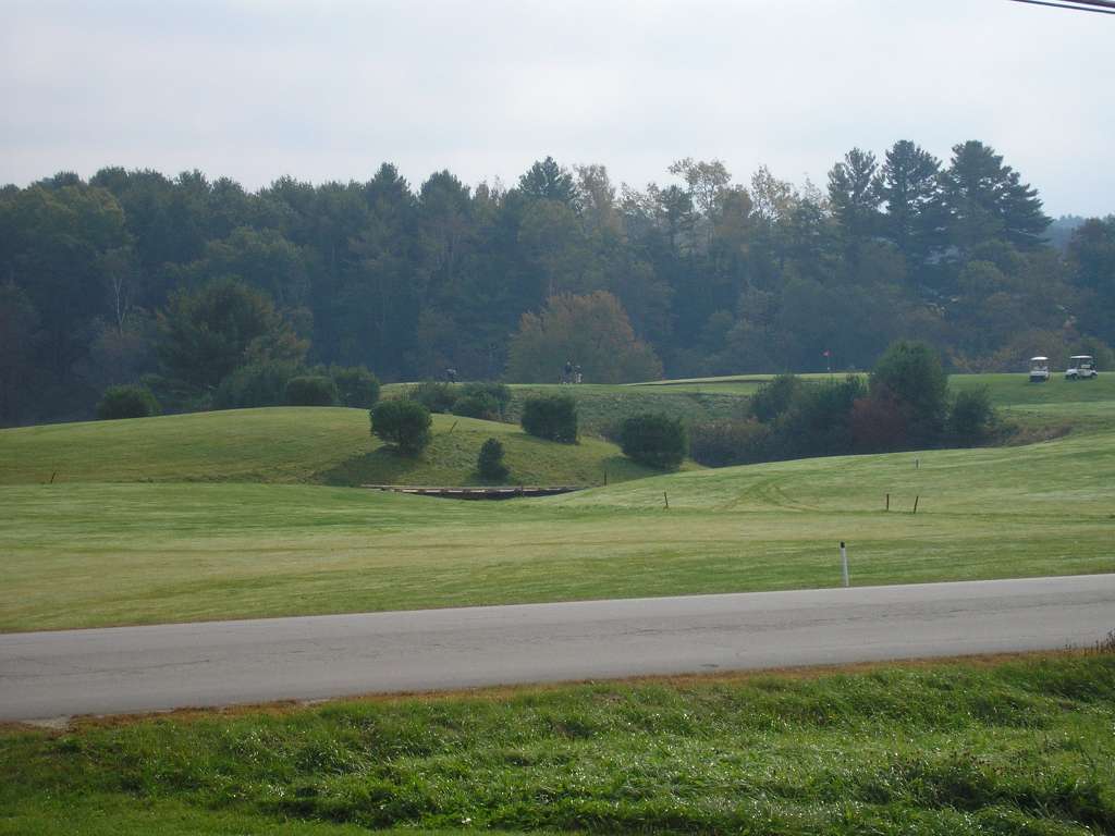
| Agency | Institute for Fisheries Resources |
| Basin | Sheepscot |
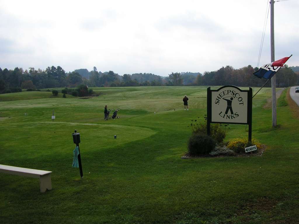
| Caption | This photograph shows the Sheepscot Links, a golf course along Highway 218. This site is located in the Mainstem Sheepscot sub-basin. Photograph was taken by Eli Asarian on 10/9/2004. |
| CaptionTemplate | [description] This site is located in the [SubBasin] sub-basin. Photograph was taken by [photographer] on [photodate]. |
| Category | Watershed Tour |
| Description | This photograph shows the Sheepscot Links, a golf course along Highway 218. |
| Filename | sheep_2004-10-09_06-58-43.jpg |
| Filesize | 65206 |
| Path | sheep_ifr_04\sheep_2004-10-09_06-58-43.jpg |
| Photodate | 10/9/2004 |
| Photographer | Eli Asarian |
| Restriction | None |
| Series | Tour- Sheepscot R. Head Tide to Whitefield 2004 |
| SubBasin | Mainstem Sheepscot |
| UpdateDate | 10/20/2004 |
| UpdateName | JEA |
| Agency | Institute for Fisheries Resources |
| Basin | Sheepscot |
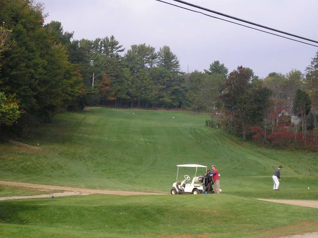
| Caption | This photograph shows the Sheepscot Links, a golf course along Highway 218. This site is located in the Mainstem Sheepscot sub-basin. Photograph was taken by Eli Asarian on 10/9/2004. |
| CaptionTemplate | [description] This site is located in the [SubBasin] sub-basin. Photograph was taken by [photographer] on [photodate]. |
| Category | Watershed Tour |
| Description | This photograph shows the Sheepscot Links, a golf course along Highway 218. |
| Filename | sheep_2004-10-09_06-58-58.jpg |
| Filesize | 79028 |
| Path | sheep_ifr_04\sheep_2004-10-09_06-58-58.jpg |
| Photodate | 10/9/2004 |
| Photographer | Eli Asarian |
| Restriction | None |
| Series | Tour- Sheepscot R. Head Tide to Whitefield 2004 |
| SubBasin | Mainstem Sheepscot |
| UpdateDate | 10/20/2004 |
| UpdateName | JEA |
| Agency | Institute for Fisheries Resources |
| Basin | Sheepscot |
| Caption | This photograph shows the Sheepscot Links, a golf course along Highway 218. This site is located in the Mainstem Sheepscot sub-basin. Photograph was taken by Eli Asarian on 10/9/2004. |
| CaptionTemplate | [description] This site is located in the [SubBasin] sub-basin. Photograph was taken by [photographer] on [photodate]. |
| Category | Watershed Tour |
| Description | This photograph shows the Sheepscot Links, a golf course along Highway 218. |
| Filename | sheep_2004-10-09_07-00-48.jpg |
| Filesize | 74347 |
| Path | sheep_ifr_04\sheep_2004-10-09_07-00-48.jpg |
| Photodate | 10/9/2004 |
| Photographer | Eli Asarian |
| Restriction | None |
| Series | Tour- Sheepscot R. Head Tide to Whitefield 2004 |
| SubBasin | Mainstem Sheepscot |
| UpdateDate | 10/20/2004 |
| UpdateName | JEA |
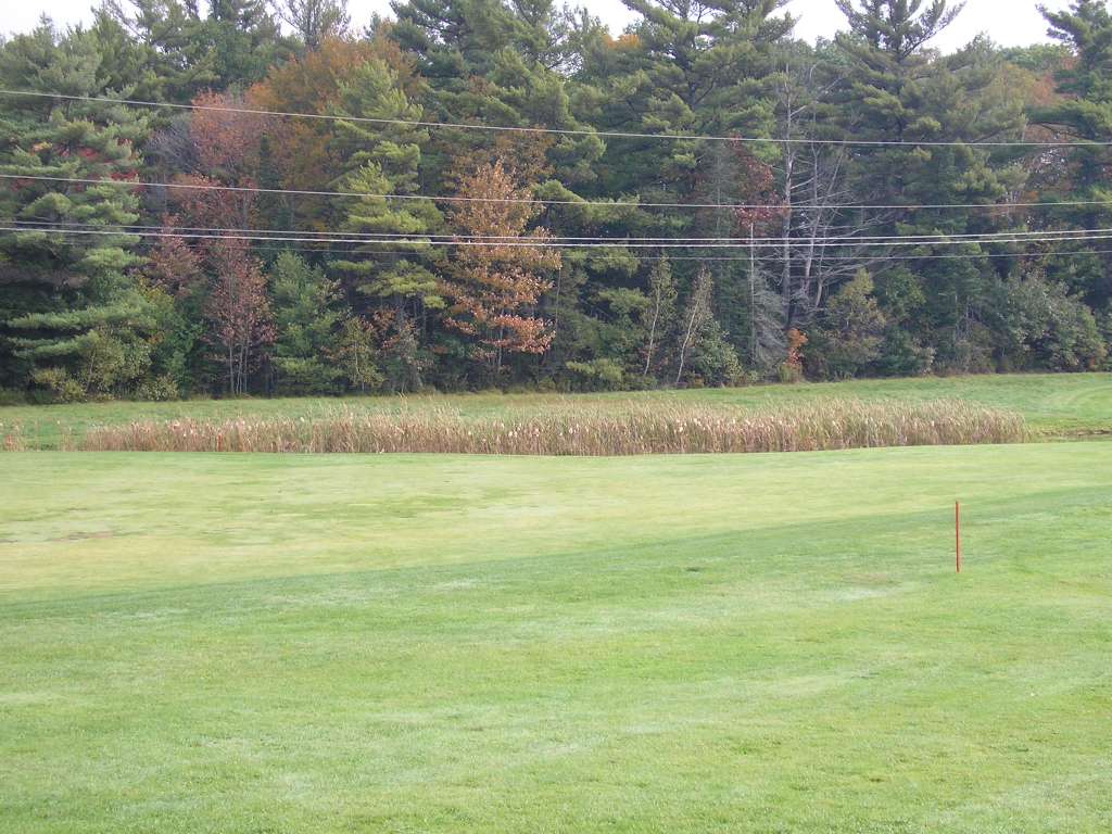
| Agency | Institute for Fisheries Resources |
| Basin | Sheepscot |
| Caption | This photograph shows the Sheepscot Links, a golf course along Highway 218. A detention pond was installed to control storm runoff. This site is located in the Mainstem Sheepscot sub-basin. Photograph was taken by Eli Asarian on 10/9/2004. |
| CaptionTemplate | [description] This site is located in the [SubBasin] sub-basin. Photograph was taken by [photographer] on [photodate]. |
| Category | Watershed Tour |
| Description | This photograph shows the Sheepscot Links, a golf course along Highway 218. A detention pond was installed to control storm runoff. |
| Filename | sheep_2004-10-09_07-02-25.jpg |
| Filesize | 119033 |
| Path | sheep_ifr_04\sheep_2004-10-09_07-02-25.jpg |
| Photodate | 10/9/2004 |
| Photographer | Eli Asarian |
| Restriction | None |
| Series | Tour- Sheepscot R. Head Tide to Whitefield 2004 |
| SubBasin | Mainstem Sheepscot |
| UpdateDate | 10/20/2004 |
| UpdateName | JEA |
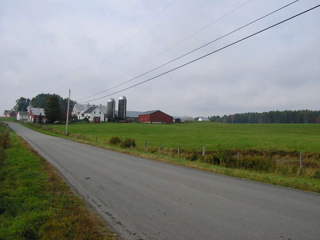
| Agency | Institute for Fisheries Resources |
| Basin | Sheepscot |
| Caption | This photograph shows the a farm scene, taken from along Highway 218 between Head Tide and Whitefield. This site is located in the Mainstem Sheepscot sub-basin. Photograph was taken by Eli Asarian on 10/9/2004. |
| CaptionTemplate | [description] This site is located in the [SubBasin] sub-basin. Photograph was taken by [photographer] on [photodate]. |
| Category | Watershed Tour |
| Description | This photograph shows the a farm scene, taken from along Highway 218 between Head Tide and Whitefield. |
| Filename | sheep_2004-10-09_07-11-55.jpg |
| Filesize | 57931 |
| Path | sheep_ifr_04\sheep_2004-10-09_07-11-55.jpg |
| Photodate | 10/9/2004 |
| Photographer | Eli Asarian |
| Restriction | None |
| Series | Tour- Sheepscot R. Head Tide to Whitefield 2004 |
| SubBasin | Mainstem Sheepscot |
| UpdateDate | 10/20/2004 |
| UpdateName | JEA |
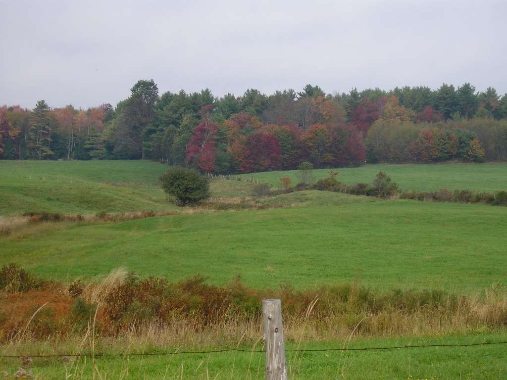
| Agency | Institute for Fisheries Resources |
| Basin | Sheepscot |
| Caption | This photograph shows the a farm scene, taken from along Highway 218 between Head Tide and Whitefield. This site is located in the Mainstem Sheepscot sub-basin. Photograph was taken by Eli Asarian on 10/9/2004. |
| CaptionTemplate | [description] This site is located in the [SubBasin] sub-basin. Photograph was taken by [photographer] on [photodate]. |
| Category | Watershed Tour |
| Description | This photograph shows the a farm scene, taken from along Highway 218 between Head Tide and Whitefield. |
| Filename | sheep_2004-10-09_07-12-04.jpg |
| Filesize | 78549 |
| Path | sheep_ifr_04\sheep_2004-10-09_07-12-04.jpg |
| Photodate | 10/9/2004 |
| Photographer | Eli Asarian |
| Restriction | None |
| Series | Tour- Sheepscot R. Head Tide to Whitefield 2004 |
| SubBasin | Mainstem Sheepscot |
| UpdateDate | 10/20/2004 |
| UpdateName | JEA |
| www.krisweb.com |